Geography: Location, Climate, Vegetation
When researching on the geography of the Ancient Kingdom of Mali, very little was found. Of the information I found, the geography seemed to be incredibly similar to present day Mali.
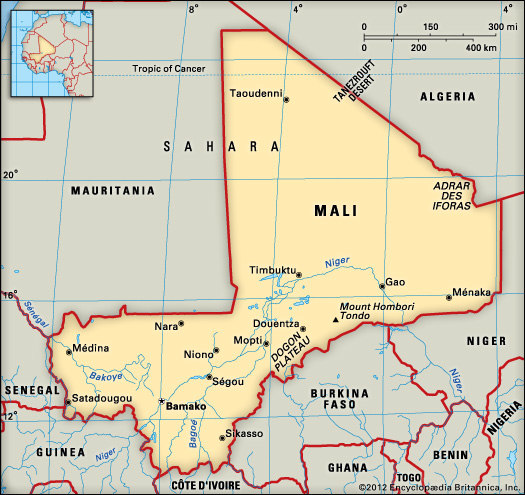
Mali is a landlocked nation located in West Africa, extending south-west from the southern Sahara through the Sahel to the Sudanian savanna zone. It is bordered by Algeria to the north, Niger to the east, Burkina Faso and Côte d'Ivoire to the south, Guinea to the south-west, and Senegal and Mauritania to the west. It is the largest country in West Africa being over 480,000 square miles in size.
The entire country of Mali is situated on a plateau giving it a very flat surface, rising in the northern region due to rolling plains which are covered in sand.
The northwestern region of Mali, which extends into the Sahara, is almost entirely desert or semi-desert. In the southwestern region, rainfall and rivers are more plentiful, making this area more lush than the rest of the country. However, there are occasional floods and the torrential downpours wash away soil nutrients causing land erosion In the central region, known as the Sahel, lies the most notable geographic feature of Mali which is the Niger River. It arcs northeast through Mali from Guinea before turning south and eventually emptying into the Gulf of Guinea. The Niger River is the main source of water for Mali and is used for drinking purpose, irrigation, and industrial use. "The Niger,like the Nile, is both a critical source of sustenance and a major transportation artery--and in this latter capacity it is an excellent venue for boat travel." There are three other main rivers apart than the Niger, which are the Bafing, Bakaye and the Senegal.
Since Mali lies near the Tropic of Cancer, the climate is mostly tropical. The winters in Mali are dry while the summers are very hot and humid. The average temperatures are quite high ranging from 24° and 32°C.
Vegetation in Mali is not very plenty. As it is a part of Sahara desert, shrubs
and short grasses are common in the region.
